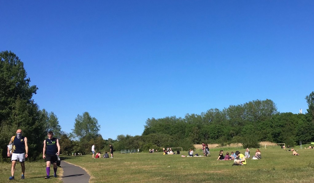
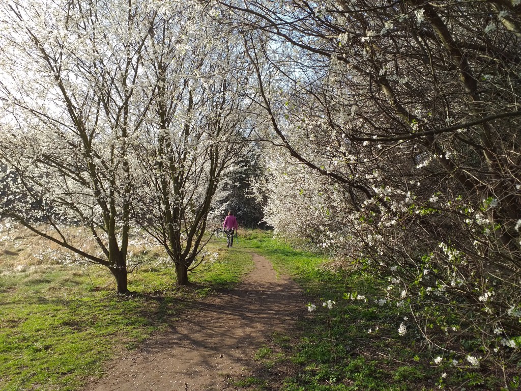
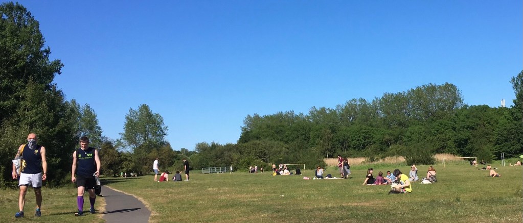
Iris Brickfield Park is an attractive green space located in the east of Heaton between Whitefield Terrace and the East Coast Mainline. Whilst it is smaller than Heaton’s other parks it is nonetheless an important local amenity which is well used by local people.
Although the name of the park gives us a clue to part of the site’s history (a brickfield being an area of ground where bricks are made) many visitors are perhaps not fully aware of the various uses this land has been put to over the last 120 years.
Fields
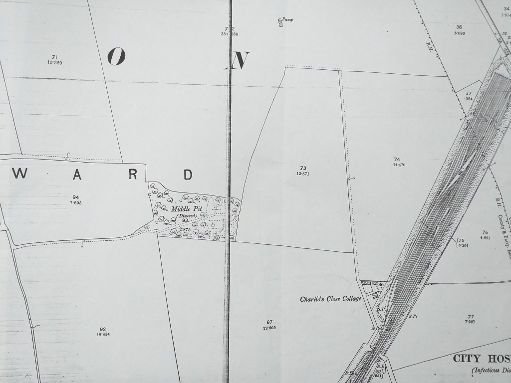
At the end of the 19th century the area now occupied by the park and adjacent allotments was farmland which had traditionally been farmed by East Heaton Farm. The OS Map of 1898 (below) shows three fields (numbered 73,74 and 87) to the east and south east of the former site of Middle Pit (which was roughly located where Rokeby Terrace now stands) and it is in this area that the park is located. The building of the Newcastle to Berwick railway line, which opened in 1847, had separated these fields from East Heaton Farmhouse although it appears that an underpass beneath the line had been provided to allow access, visible at the bottom right hand side of the image. The only residence in the vicinity at this time, known as ’Charlies Close Cottage’, was located on part of the site now occupied by the Colas depot on Rothbury Terrace.
At this time the housing development which was taking place in Heaton had not yet extended to any significant extent into the area east of Chillingham Road. However, development was creeping inexorably closer and by the time the third edition of the OS map was published in 1916 (below) the area between Chillingham Road and the railway line looked very different.
Bricks
In 1903 the Standard Brick Company had started to operate a quarry in the area which would later become our park. Demand for bricks at this time was strong and the availability of good quality brick-making clay under this area had been known for some time. Indeed there had previously been another brickworks very nearby, just on the other side of the railway line in East Heaton (near the site of the Heaton Colliery’s Old Engine Pit and East Heaton Farm). This was the Heaton Points Brick Company which appears to have operated between around 1879 and 1893. The 1898 OS Map also shows two other brick works slightly further to the south (the Byker Hill Brick Works and Lawson Main Brick Works).
Adverts for the Standard Brick Company show that it operated ten sites across Northumberland and Durham. However, by 1908 this company had gone into receivership and the Heaton site and another at Pelaw had been acquired by James Frazer who operated them as the Iris Brick Company. Frazer was a wealthy shipowner and property developer, a well known figure in Newcastle at that time. The Iris Brick Company had its offices initially in Milburn House and later in Collingwood Street and then Queen Street in Newcastle city centre. It is often said that the name Iris was a tribute to the brick company owner’s daughter but Frazer never married and we have been unable to find in the records anyone called Iris associated with him.
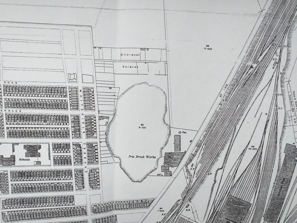
The operation was managed for the next 30 years by John Moorhead, who had been the receiver for the Standard Brick Company. The 1916 OS Map shows brickworks buildings located in the south-east of the site (roughly where the Colas Depot is today) and a substantial clay pit to the west of these. The large field north of the brickworks would later be quarried but had not yet been touched. This map also shows that allotment gardens had been established around the western and northern fringes of the clay pit (behind Whitefield Terrace and south of what would later become the eastern end of Sackville Road). At this time the clay pit had been worked for 13 years. New housing development in the area had now edged up to the western and southern perimeters of the site and it seems very likely that the bricks manufactured on the site between 1903 and 1916 would have been used in the building of the area north of Rothbury Terrace between Chillingham Road and Whitefield Terrace. However, the only place that we KNOW Iris Brick Company bricks to have been used was the area around Graham Park Road in Gosforth, which Frazer himself developed. He insisted on a clause in his builders’ contracts which stipulated that only bricks from his company were to be used. There is a copy of such a contract in Tyne and Wear Archives.
Loco
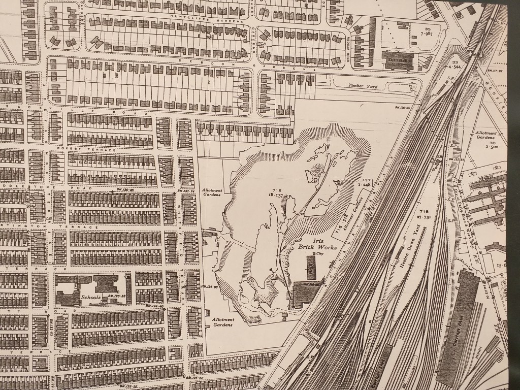
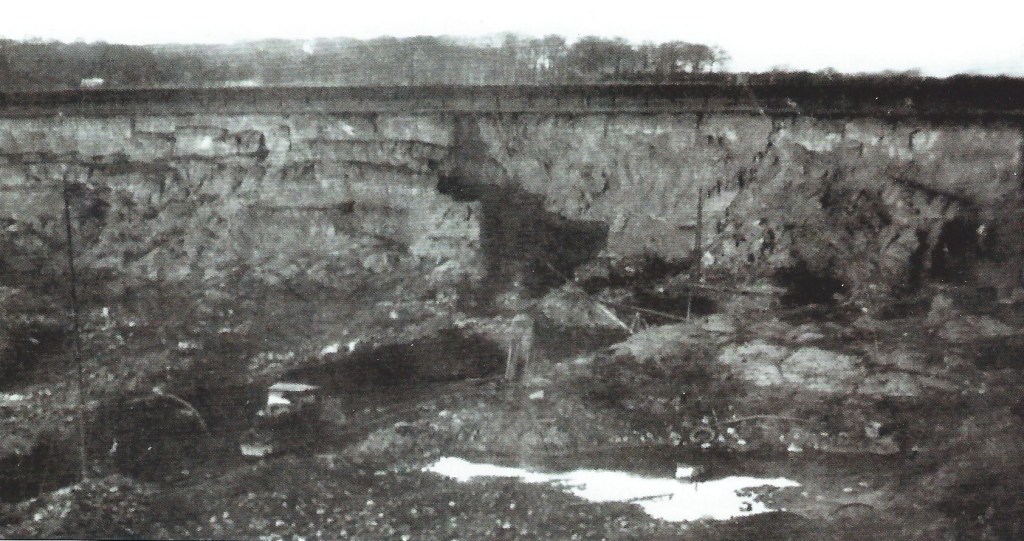
The Iris Brick Company’s Heaton site continued to operate until around the outbreak of the Second World War. The clay pit by this time was much more extensive than shown on the map of 24 years earlier (See below) having extended over much of the former field to the north of the brickworks buildings towards the East Coast Mainline and what was by then a timber yard on the south side of Debdon Gardens. It is possible that the brickworks would have provided bricks for housing developments which took place in North Heaton, Cochrane Park and High Heaton in the inter-war period.
The photograph immediately below, dating from the 1930s was taken by Walter Boyes, a pupil at Heaton Technical School. It faces north towards the Army Reserve Centre at the eastern end of Debdon Gardens, which is just visible through the trees edging the site. The photo gives a good impression of the scale of the clay pit towards the end of its life. The locomotive that can be seen in the foreground is understood to have been built in the USA for use at the paper mill of Sir W G Armstrong, Whitworth and Company Ltd in Newfoundland, Canada. Quite how it ended up in a Heaton clay pit is a mystery.
During World War II, water was allowed to accumulate unrestrictedly over a long period by the National Fire Service by whom the site was requisitioned.
Refuse
Towards the end of World War 2, in August 1945, the City Council agreed to purchase the site of the brickyard (an estimated 21.7 acres) for use as a refuse disposal site. In view of the limited life of existing tipping sites in the city, new refuse disposal capacity was needed and the Council entered negotiations with the owners to purchase the site. The site was bought for the sum of £14,500 and in November 1945 a public inquiry was held and the Minister was advised by the Inspector that the Iris Brickyard was well situated to receive refuse from certain parts of the city but had the disadvantage of flooding. Anyone who visits the site regularly will know how wet much of it still gets. There is now a huge surface water drain and tank owned by Northumbria Water under the western side of the park by Back Whitefield Terrace created to take rain water from the nearby streets.
A loan of £1,040 was subsequently agreed by the Government to fund the pumping out of the site which was necessary to allow tipping to start, although it was reported that this sum would be offset by any compensation received under the Compensation (Defence) Act, 1939, in respect of a claim to be made by the owners of the Iris Brickyard arising out of the accumulation of water during wartime requisitioning, the benefit of which transferred to the Council with the site.
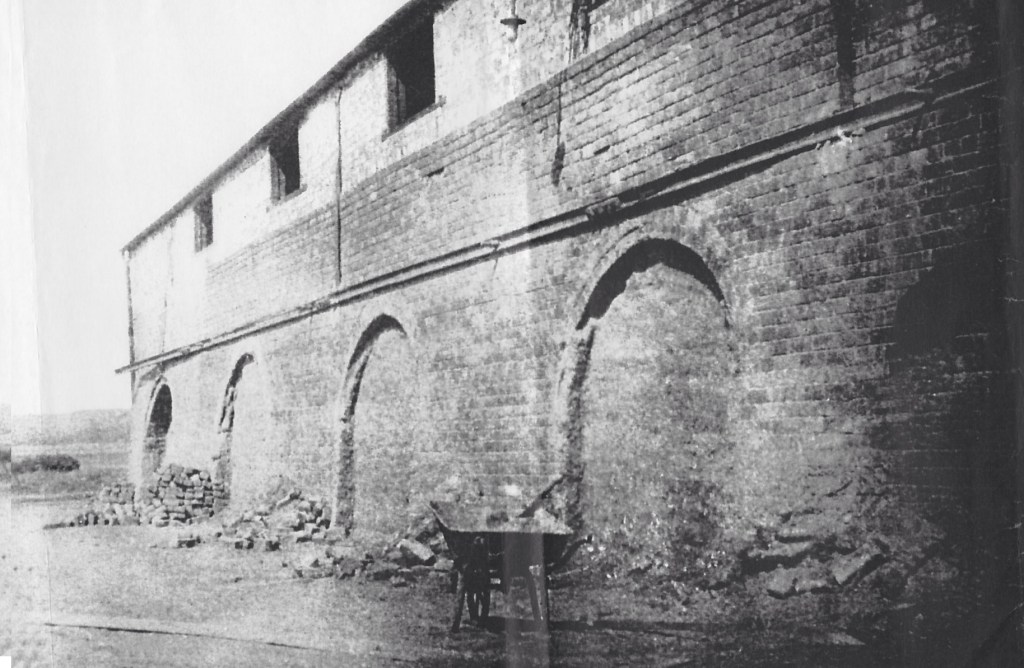
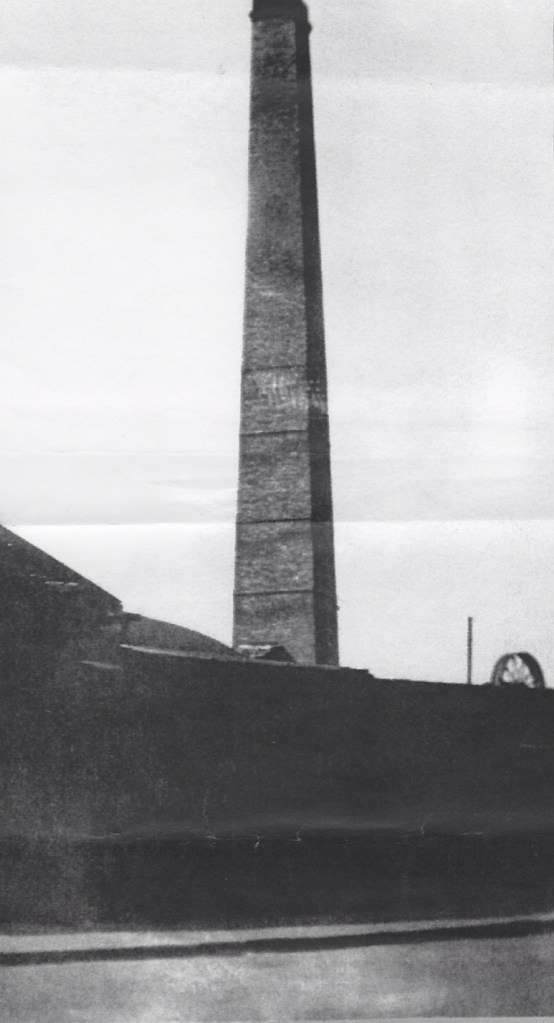
Between 1946 and 1961 the old clay pit served as a waste disposal site. It seems that the existing allotment gardeners around the perimeter of the site were unaffected by this development. The 1957 OS map shows allotment gardens around the western, southern and northern perimeters of the site. Most of the brickworks buildings no longer exist at this time although a chimney and one small building remained on the site. Chldren continued to play on the site during this time and one boy is know to have drowned in the deep pond which remained.
Allotments
In January 1962 the City Council received a report which noted that tipping on the Iris Brickfield site had been completed and the land was now zoned for open space. It was pointed out that although there was considerable demand for allotments in the area, due to proposed redevelopment of the whole Iris Brickfield site, 73 allotment holders would be displaced. The Town Planning Committee therefore agreed to use 4.42 acres of the site for the creation of model allotments – the Iris Brickfield allotments which lie to the south of the current park. The land at the time was reported as being totally lacking in topsoil and wholly unsuitable for cultivation and it was necessary to provide 8,000 cubic yards of good topsoil. The scheme was to include sixty-five plots each of about 300 square yards, along with a communal pavilion and store hut with toilet and light refreshment facilities. The plots were to be let at an exclusive rental of £3 per annum. At around the same time just over an acre of land was appropriated by the Town Improvement and Streets Committee, this land forming the site of the City Engineers Rothbury Terrace Depot and providing land for its further expansion.
Park
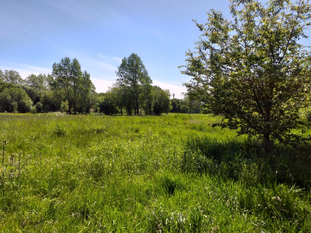
In July 1964 a detailed scheme for the development of public playing fields on most of the remaining site (comprising an estimated 14.2 acres) was put forward to the Council with an estimated cost of £38,000. The first phase of this, involving leveling the area, providing top soil and ground preparation works, providing plants, trees and shrubs and the erection of fencing and walling was estimated to cost £12,000. Exactly what the full scheme envisioned in 1964 comprised is not known but the outcome of work completed was a rather featureless grassed recreation field bisected by several paths, with trees confined to the perimeter of the site. It was somewhat unloved by local people.
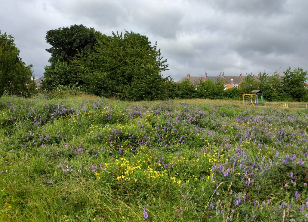
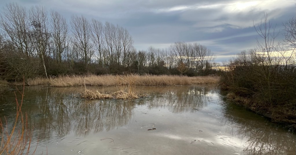
No further major changes to the park were to take place until the 1990s when several substantial copses of trees were planted in the western half of the park and a new pond was excavated in the eastern half with the intention of increasing its attractiveness and ecological value. Since the turn of the century the biodiversity of the park has been further enhanced as large areas of grassland which were previously mown on a regular basis have been left uncut and wildflower meadow areas have been created. A community orchard has also been planted and in several areas tree coverage has extended through natural regeneration.
The pond created in the 1990s, now well established, attracts many species of birds, insects, frogs and bats and a botanical survey undertaken in recent years by local naturalist James Common recorded 159 plant species in the park. Fundraising by Friends of Iris Brickfield Park led to the erection of a boardwalk and platform to allow closer access to the pond. Sadly the platform was burnt down one bonfire night and so it was replaced with the metal one we see today.

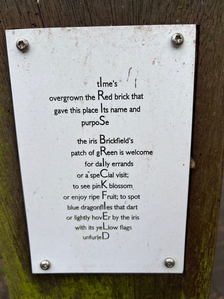
In 2011, a community arts project led to the erection of the Wild Iris Walk, a poetry trail around the park, one aim of which was to draw park users’ attention to the biodiversity of the space. The two children’s play areas have also been improved relatively recently.
The park is now managed by Urban Green. It is protected in perpetuity as a green space as a result of a binding legal agreement between the landowner and the charity, Fields in Trust. Almost 60 years since the original creation of the park, its value to the local community and to wildlife is greater than it has ever been. And appropriately every year in May, yellow flag irises bloom on the edge of the pond.

Acknowledgements
Researched and written by Alan Richardson of Heaton History Group with additional material by Chris Jackson. Thank you to Mrs Lesley Middlemiss for the photograph of the clay pit. Mrs Middlemiss’ father, Thomas Lesley King, taught at Heaton Technical School on Trewitt Road and encouraged his surveying pupils to take photographs during their fieldwork in the local area.
Can You Help?
If you know more about the history of Iris Brickfield Park or anyone or anything mentioned in this article, we’d love to hear from you. You can contact us either through this website by clicking on the speech bubble immediately below the article title or by emailing chris.jackson@heatonhistorygroup.org
Sources
‘A Celebration of Our Mining Heritage’ / Les Turnbull; Chapman Research in conjunction with the North of England Institute of Mining and Mechanical Engineers and Heaton History Group, 2015 (ISBN 978-0-9561248-2-1)
Council minutes and other records
Common Room library
Originally published 20 January 2024.
Well done Alan and Chris, an enlightening project long overdue.
I rode my bike around a dry clay path there, back in the early ‘sixties, with much skidding and dust raising generating a novel experience.
I may have spoken of the pontoon once before but it is worth mentioning again given its relevance to the article:
my grandfather (along side the well-known Arthur Clough) was in the Auxilliary Fire Service during WW2 and when they were not putting out fires they were schooled in pipe welding, and set about providing water supplies to appropriate areas. Greys Monument was a good example, with a pipe running up the western gutter of Dene St and Grey St from a pumping station on the riverside.
More to the point, a pontoon was floated into the middle of the lake in the brickfield quarry with a petrol driven pump on board and a pipe running over towards the marshalling yard, which was obviously a prime target for bombers, as Guildford Place can testify.
Seemingly, ‘static water tanks’ were established all over the city: one was behind Byron Street in Shieldfield to benefit the Goods Yard. Three days of hosing the conflagration of sugar and butter will have rapidly drained that one.
Sorry I hi-jacked your article.
Incidentally: all photographic records of the Good’s Yard fire, held by the Fire Brigade, were lost – ironically enough – in a flood of the Pilgrim Street building some time ago, unless anyone out there knows otherwise… please let me know – if so.